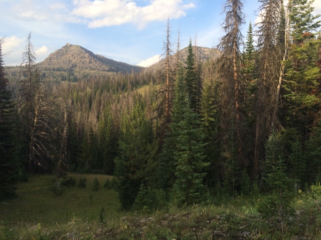
Mileage: 30.5 miles (1795.7-1826.2)
I started out by crossing the frigid South Fork Buffalo River, kicking myself for not crossing it the night previous. My feet felt like ice cubes as I quickly shuffled across the stream, too deep to allow me to hop across rocks. I kept my shoes on as it would allow me to move faster across the icy river, though it would mean sopping wet feet for a couple hours. These are the tradeoffs of long distance hiking.
After crossing I took a little detour to the South Fork Buffalo Falls, a dramatic 40 ft waterfall that has carved a serpentine canyon in the otherwise flat and open terrain. I was in awe as I crept up to the cliff's edge and realized you could literally jump across the slot canyon, it was so narrow at the top. But I certainly wasn't going to try as it was at least 50 ft down to the river below and you probably would end up pretty battered by branches and rocks before you ever reached the canyon floor.
I took a few photos and headed back towards the trail ascending and then heading down through Nowlin Meadow and its defunct one-room Ranger Cabin. I met the first Southbounder of the day there and we chatted for awhile about the upcoming trail north and south.
From there, I wound my way up and down through meadows and across streams, most of which didn't have bridges, but I'd hop rocks when I could, desperately (and failing) to keep my feet dry after I'd taken such care at lunch to dry them out. The trail was like a horse super highway most of the day, very wide and full of horse shit. I saw a couple horse camps along the way and wondered if they had permits or how the operations worked right within the wilderness. Again, someone was making a lot of money on what was supposed to be 'a place untrammeled by man.' But horse crap everywhere and trails that are so deeply rutted that the mud is a permanent fixture, is okay. I don't get our land managers sometimes - but it probably has something to do with money. Horses should be like dogs - if you're gonna take 'em out on the trail, fine - but you have to pick up their shit.
I met a couple section hikers and then a flipper with what I assumed was his wife and daughter. Another flipper walked up as we were chatting and I left soon after as I needed to get close to the Yellowstone National Park Boundary if I was going to meet my friend Pat the next day 30+ miles north of the line near Lake Village.
I walked into the Two Oceans Valley and then made a quick trip to Parting of the Waters, where Two Oceans Creek literally splits and one way goes to the Pacific Ocean and the other, the Atlantic. Pretty neat! I took a bath in the Pacific side and ate my dinner of Ramen noodles. I got going again around six, leaving the "official trail" to start my 350 mile sideroute up towards Yellowstone and then Montana. In the end, it would save me 150+ miles and I'd get to see a part of Yellowstone most never see - the remote Thoroughfare Trail (misleading, I know!) and the eastern side of the park.
I passed through a couple more huge meadows and eventually into the Yellowstone River drainage, following a horse trail along the way. It started raining and I started seeing Grizzly sign everywhere - huge, fresh prints and lots of scat.
It was getting dark and it was muddy from all the rain so I couldn't move nearly as fast as I wanted to and I just kept imagining every bush as a bear. Luckily, I made it to the horse camp I was aiming for right before dark and setup my tent. I met a couple guys from North Platte, NE there and we talked for a bit. Funny who you run into on the trail. Time for bed.


Hi Dan. Great adventure! I loved reading about your travels.
ReplyDelete