Tuesday 28 July 2015

Day 97: Over Knapsack Col and catching Restless

Mileage: 27.2 miles (1729.3-1756.5)


I woke up around 5am unable to sleep anymore but too cold to get out of my sleeping bag - a big change from the night before when it was so hot I didn't want to use my bag at all. I stared at the ghostly outlines of Fremont and Sacagawea Peaks, trying to make out Gannet, the tallest mountain in Wyoming, to the north. I was surrounded by the tallest peaks in the state, many with glaciers still hanging on them - though, they are rapidly melting and the map suggests they are just shadows of what they once were.


I waited for the sun to heat up the thin and chilly morning air, but I was sitting right below and to the west of a wall of nearly 14,000' peaks that would make that a slow process, so eventually I'd just have to get up. The clouds from the night before had finally passed and the winds subsided some, though I imagined up at the Col they'd still be roaring.


Gusts of wind had shaken my tent all night long, so I knew how powerful they could be, even where I was at 10,500' in the basin. Finally rousing myself, I started walking, wearing my gloves for the first time since Colorado.

I ran into a guy, who from a distance reminded me of my friend Restless, who I hadn't seen since New Mexico. I knew it was crazy, especially since the guy was walking the wrong way, but sometimes you intuitively know something that your brain just won't let you believe. Whether it's cues from the atmosphere, a scent drifting in the air, or electrical currents leftover from the storm, sometimes coincidences can't be explained. And this was one of those cases.


It turned out the guy was not Restless, but Restless's friend, and they had just been camping together. He told me I was only a few miles behind Restless himself! I didn't tell him about my feeling when I saw him, but filed it away as a reminder to trust my gut even if I didn't know why. 


With new vigor I scrambled through the Cadillac and even house-sized boulders, past the last remnants of glaciers, shadows of their former selves and up towards Knapsack Col. Staring up at the Col I wondered how the hell I was gonna get there. From my vantage point, the path looked straight up a loose scree and boulder field, with patches of snow and ice in between. I decided to keep going, to get a closer look, vowing to turn around if it became unsafe. There was no one to save me if I slipped or fell deep into a crevasse.


So, I picked my way through, ending up a bit too high, so had to come down and finally came to the pass after a one last scramble. As I'd gotten closer, I found it was steep, but totally doable, even if there wasn't a clear path with cairns. And the view into the northwest amphitheater made all the effort worth it. The towering peaks were glowing a bright orange, surrounding the headwaters of the Green River, the main tributary to the Colorado. These same waters I walked on as snow later would flow through the Grand Canyon and out into the Gulf of Mexico.


Descending from the Col I met couple doing a high route through the Winds, something I'd love to do someday. They asked some questions about the CDT as that was on their to-do list. I kept yelling, "Restless, Restless!" knowing he wouldn't be able to hear me over th roar of the river.


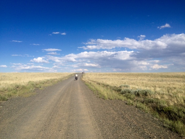
I finally caught up to Restless after an insane waterfall, rushing from the highest lake in the watershed. I yelled his name and he looked back with a blank stare. I told him it was Lt. Dan and he still didn't get it until I walked right up to him and gave him a hug - we hadn't seen each other since New Mexico. We caught up as we walked through what we agreed was perhaps the most incredible section of trail so far, with towering monoliths on each side, and around each corner lay yet another sheer, rugged granite peak. We were in awe, pausing at every aquamarine alpine lake, each like a mirror reflecting their mountain in the morning light.


We passed through endless Alpine meadows and more hulking granite towers. It was alll downhill from Cube Pass, so it was wonderful hiking, a relief from the intensity of the last few days. Me and Restless plotted trying to catch up to Maniac and Karma by taking the Butte Super Cutoff, which is shorter than the official route, and some say more scenic. We were both worried about finishing before snow in Glacier, especially since I was taking another week off with my dad in the Tetons.


We managed to get down to the Green River Lakes campground, seeing canoers and kayakers, as well as quite a few more backpackers. One of the guys we met had a 90+ lb pack, including an inflatable boat. Literally, a BOAT. He could barely stand while he talked to us and we cut it short feeling bad for him. He had told us, "sometimes, I've found a boa is helpful to get all my gear across rivers." And I was thinking, "dude, you wouldn't need a 15 lb boat if you didn't have so much shit!" But to each his own. We met another guy who was on his way out and he offered me a ride out to Pinedale that night.


After waiting for the guy to catch up, I said goodbye to Restless in the parking lot. Me and the dude had beers and burgers at a brewery/burger joint in town. He got the last hotel room, which I had tipped him off too, yet somehow even with the extra bed he didn't think to offer it up. Instead, insanely tired from the long day, I begged a bed and breakfast to let me tent in their yard. They said that would be illegal, but pointed me to an old KOA just a few blocks away. Whe I got there, I laid down my tent as a groundsheet under a tree and promptly fell asleep. 

Monday 27 July 2015

Day 96: Northwest towards the Titcomb Basin

Mileage: 27.9 miles (1701.4-1729.3)

The mosquitoes were horrendous yet again this morning. I thought they couldn't fly when it was as cold as it was this morning, but they sure could! I passed Moss about 30 mins in and she startled me, camped under a tree right next to the trail. I said, "good morning" but couldn't shake the awkward feeling of the night before so just kept moving. 

There were an incredible amount of lakes here, big, small, named and unnamed, all offering great opportunities to bathe and cool off, which I took advantage of after a few hours of walking that morning.


A cold front rolled in late morning, and it was kind of cloudy all day. All of a sudden it started hailing, or 'groppeling' which the only difference I can tell is 'groppel' sounds German. Big quarter-sized balls of hail that stung as each pelted my head and arms. I hid under a dense clump of pines to shield myself. The storm passed after about 15 minutes and I resumed walking.


I saw a ton of flyfisherpeople, all seeming to have pretty good luck. I was lucky I ran into one group who knew the area well, about 500 ft after I'd taken a wrong turn. They pointed me in the right direction and the older gentlemen was so adorable and knew everything about everything - from every trail I'd hiked, to be weather, and anything else that came up.


I met another group of fishermen who explained to me why all these lakes have fish. Apparently, originally only one or two of the deepest lakes had fish, but back in the '20s a guy whose name I've already forgotten made it his mission in life to put fish in the lakes - more than 300 of them by the time he was done. Lake Trout, Browns, Cutthroats, Rainbows, and even Golden Trout which are native to just one watershed in the Sierra Nevadas in California near Kings Canyon National Park. He sure was dedicated. I suspect it devastated the local ecosystem, especially native amphibians like frogs who had evolved without that predator and likely saw their demise because of them.


But now I guess you could live off fish the whole summer if you had to up here. It's crazy to think how much we manufacture ecosystems to be what we want them to be - even in places as remote as the Winds here in Wyoming.


I ran into another group who'd seen Banana Pants, the Austrian guy I'd be hiking near for probably two months, but whom I've never met. They said he wasn't going up to the Titcomb Basin so I doubted I'd see him this time either!

I dcided I'd head to Knapsack Col, another alternate, because everything I'd heard from folks who I've run into is that it is one of the most spectacular places in the Winds. I sure can't pass that up. The Winds might be one of my favorite places not only on this hike, but in the whole world. They're huge and you could spend a lifetime and never see everything. In fact, I've met plenty of folks in the last few days who've said just that. Guys who've been coming here since the '70s and '80s and still finding new things. So cool. I'm definitely coming back here.


I got into Titcomb Basin to camp, saw a few people along the way, some with campfires that I really wanted to get in on. But I wanted to get to Titcomb Lakes so I'd minimize the approach to Knapsack Col tomorrow. I met some brothers who went over it today from the other side and described it as "chaucy, but not super exposed." This translates to "there's loose rock but it's not like you're on the precipice of a cliff." I'll just have to check it out tomorrow - if it's too sketchy then I'll just come back down!


Sunday 26 July 2015

Day 95: The Cirque of Towers and Beyond

Mileage: 23.6 miles (1677.8-1701.4)

I started off the day walking past the diving board, a spot where you could stare down a 2,000 ft vertical drop from East Temple Peak. I didn't do it, mostly because I would have had to walk extra uphill, and I was anxious to get to the Cirque of the Towers, one of the most famous areas of the Wind River Range.


Big Sandy Lake had great wildflowers, with the meadows dotted with pink Parry's Primrose, Purple Lupine, Alpine Fleabane, and a yellow aster I didn't know. It was a splendid display, made all the more spectacular by the sheer granite peaks towering over the meadows.


On my way up to the Cirque I met a nice couple with dog from Grasse Valley, CA. We sat and chatted before I headed up to the pass, where I could check out the Cirque for the first time. 


From my first glimpse, I realized the Cirque was truly incredible. It's a place that reminds me most of Yosemite, with its impossibly sheer cliffs, framed by a brilliant blue sky. There were towers with names like Sharknose, Warrior Peak, the Watch Tower, and most famous of all, Pingora Peak, a very popular climb for rock climbers around the world.


I ran into some Boy Scouts, who, once they heard what I was doing, gave me a block of cheese ("We each have a block, you want mine?") and graham crackers and water. They were in awe and asked all sorts of questions. My favorite was, "Do you have a before picture?" No one has ever asked me that before so I had to check. It turned out I did and when I showed it to them, there were a lot of "whoa's".  I'm still not sure how to take that one. After they'd got their fill of questions I was about to leave and a kid had one more question: "But, how did you get to the Winds? Did you get a ride?" I guess it hadn't quite gotten through that I'd literally walked to the place we were sitting from Mexico. I guess it hadn't really hit me yet either. It actually happens a lot. I have to say, "No, I didn't get any rides, I walked literally here from Mexico. On foot. I don't have a car."


Leaving the Scouts And heading up to Texas Pass I saw some climbers way high on spire. Crazy. Down Texas Pass in the valley North of the Cirque there was loose footing and it was quite steep, so I was glad I had my poles. I went down into another Cirque and past a couple more lakes, descending back towards the CDT. I met a couple hikers and chatted on way down, happy to take a break from all the climbing I'd done that day.


After I joined back with trail I chatted with nice couple from Salt Lake. It's only four hours to the Winds from there, which is nuts. The man had spent a lot of time in the Winds climbing back in the 70's so it was cool to hear some about that.


With the sun setting I saw a hiker up ahead who was moving pretty slow. It looked like an older man, who was a bit heavyset. It turned out to be another CDT hiker, Moss, a woman probably in her 40's in baggy clothes which made her figure larger than it actually was. We hiked together and talked for about a half hour and then I setup camp and Mosquitos swarmed. It was kind of a weird moment. Moss was like, "that looks like a good campsite" - it was flat, but really low next to a swamp. I didn't think it was, but I I was very tired, and it was almost like she wanted me to camp there, so she could camp alone. I can't explain why it was awkward, but it was almost as if she was afraid of me or something. I shrugged it off, endured the swarming mosquitoes as I setup my tent and fell asleep, exhausted by all the elevation change of the day.


Saturday 25 July 2015

Day 94: Into the Winds

Mileage: 25.7 miles (1652.1-1677.8)

My pack felt heavier than its been my whole hike. It's the damn bear barrel. They are required in Teton National Park, where I'm headed to meet my dad, so I figured it just made sense to carry it there. A lot of people have warned me about bears, so maybe it's good I have it, but it sure is a pain in the ass. I have to assemble my pack just right so it doesn't sit directly against my back. Eventually I figured out my sleeping bag plus my tent enveloping it was basically the only way to pack it comfortably. It also took up a ton of room because it would only pack vertically. Ugh.


When I wasn't thinking about the weight of my pack, the familiar pair of wild roses and lupine graced my eyes, while fragrant accents of sage and dry pine needles wafted through the air. I climbed up and down in the foothills for the better part of the day, until I turned off for the Cirque of Towers alternate, about 19 miles after I started. The route is supposed to be one of the most spectacular parts of the trail so I was really excited - in fact, many past hikers had told me the Winds were their favorite part of the trip - a lot to live up to!


Once I started heading up the valley I began seeing the sheer cliffs and spires up close for the first time. Some rose over 1,500' from the valley floor, making it no wonder climbers came from all over the world to scale the walls (don't worry, I won't be doing any scaling!). The cliffs to the east were illuminated by the late afternoon sun, accented by the bright blue sky and big puffy clouds moving quickly over the peaks.


 The mosquitoes were horrendous, but as long as I kept moving I was okay. I'd swat three of four off my shoulder every five minutes or so, making sure they didn't have enough time to squeeze their needle-like sucker through the fibers of my shirt. It was just when I stopped that they'd almost instantaneously swarm. One such occasion was when I cooked my Mac and Cheese dinner (thanks frisbee friends!). I put on my down jacket and deployed my headnet for the first time on the trip, to keep them from flying into my mouth. 


I packed it up before it was cooked fully, letting it finish in my backpack microwave. The microwave consists of wrapping up my pot in my rain pants after the water boils, placing it my pack securely so it doesn't spill, and that's enough to cook the noodles after a half hour or so ... while I'm walking! That way I don't have to waste precious fuel or allow the mosquitoes to turn me into their dinner.


After I ate I walked a bit more and stumbled upon a beautiful glacial lake right below the pass. I setup camp quickly and took an icy bath before bed at 11,000 feet. It was exhilarating to feel the frigid water on my skin. I basically jumped in and right back out, allowed the wind to dry me some and then used my small pack towel to finish the job. I then put on a clean shirt and log underwear, which will make sleep marvelous. Laying down in the tent I can tell the big pack is taking a toll on my legs and I definitely can't make as many miles. Also, there was quite a bit of elevation gain today. It's unlikely I'll make it to Dubois, as I hoped before I meet my dad, but I don't want to rush through the Winds anyways, so we'll see how I do tomorrow.


I'll wake up early and head towards the Cirque of Towers, woohoo!

Friday 24 July 2015

Day 93: On through Atlantic and South Pass City

Mileage: 25.9 miles (1626.2-1652.1)

I woke up a little before 4am with the stars shining bright above me. The first light of dawn was just starting to brighten up the eastern horizon. As I walked shooting stars danced above me: one, two, three. I made a wish for health and then love. I tilted my head back towards the night sky, still deep and dark above me, noticing the Milky Way and the myriad of constellations I couldn't begin to name.

One I did know, the Big Dipper, shined brightly to north, lower and bigger than I'd ever seen it. Slowly, the stars melted back into the sky like snowflakes on a warm winter day. To the East, the sky was lightening, first with the soft orange which gave way to bright, deep blue. A cluster of dark, scattered clouds all had their bottoms frosted with pink and gold light. Together, the clouds resembled a Phoenix, the mythic bird which rises from its own ashes after it dies, signaling renewal and rebirth of a new day and new chapter for my hike.


Tomorrow, I'd leave the Red Desert behind and enter the Wind River Range, one of the most remote and spectacular mountain ranges in the continental U.S. Grizzlies and wolves still roamed there, showing it still has a wild and rugged spirit that most of our other natural places had lost to the vices of humanity: agriculture, mining, industrial tourism, and the like. 

Male antelope huffed and puffed at me as I walked by, defending their territory. I tried to communicate I was only passing through, but it always seemed to be lost in translation as the agile creatures would inevitably hop off, afraid of my humanity.


I got into Atlantic City 20 minutes before restaurant opened. I met some Great Divide bikers from Vermont and other places and ate a normal sized breakfast burrito that was described to me as "huge." To compensate I then had pancakes and eggs and sausage with a few cups of coffee. I bought some extra supplies, used the Internet and then headed to South Pass to grab my package.


I passed by a cool old mine, Cass Mill on the way and read about the history of the place on signs. The whole town of South Pass City was just as it was back during the 1860's and '70's during the gold rush here: an I ld saloon, hotels, pharmacy, etc, all restored with artifacts inside. A nice lady at the souvenir shop gave me my packages and I also bought a cream soda and a Klondike bar (what would you do for a...)


I got an awesome care package from a group of friends back home and nearly cried reading all their notes. It would have been a happy cry, but I didn't quite realize how much I missed them all until I got their notes. Of course, they also sent food, which was a great addition to my lean resupply (though, now my bag is like a behemoth!)


It was hilarious because I read all these nice notes they sent and pictures they drew - mostly stick figures, though some of them can really draw - but anyways, I was looking at all these sweet notes and then I opened one that said, "FUCK YOU, DAN!" Which was so completely unexpected that I laughed out loud for a good while. Thanks y'all if you're reading, it definitely brightened my day!!


I headed out from South Pass reluctantly into the hot sun and driving headwind around 3:30pm. The mountains were getting closer - I was entering the foothills of the Wind River Range. Trees and water all of a sudden were more plentiful and the gentle divide started looking a bit more craggy again. 


I stopped around 8pm, my feet ached from switching back to a new pair of shoes (I ditched Shopko shoes), but I think they'll be better in the long run. Very tired and ready to sleep. 


Thursday 23 July 2015

Day 92: Crooks Mountains towards Atlantic City

Mileage: 36.1 miles (1584.1-1626.2)

I was up by 5:15 and was walking about 25 minutes later. It was a cool morning so I wore my down hoodie - the same one I wore high in the San Juan's and low back in the New Mexican desert. It's served me pretty darn well from when I've been freezing cold to just mildly chilly, like this morning.


The sun hadn't quite risen when I started walking, but the sky off to the south and west was already a soft orange and blue. As the sun slowly made its ascent the hues of the western horizon changed subtly before they took on a bright blue it would wear until the sun made its way over to it, readying to set.

The antelope were once again plentiful - the guy at the motel in Rawlins told me Antelope jerky is just wonderful, as is Antelope hamburgers. I couldn't get the thought out of my head, imagining them as little burgers trotting upwards of 70mph. No wonder they were scared of me - they could probably see it in my eyes.

The day was blustery, much more so than the days previous. It did keep me cool, but the trail was headed due west, which unfortunately was directly into the wind. I ran into two sheep, the only two I'd seen in weeks - they must have escaped and definitely looked lost.


Puffy clouds rolled in in the early afternoon. Then I ran into the Oregon Trail at something called the Seminole cutoff. Then I started thinking about a question that I've been thinking about for a long time: "Who can really blame the settlers for killing all the buffalo?" I mean we all saw how fun it was in Oregon Trail the computer game, where you'd shoot 3,456 lbs of buffalo, but only be able to bring 115 lbs back. 

Continuing with Oregon Trail (the game) I remember as I kid I'd name the other settler children after my little brother and older sister - Ben and Katie. At first, you think this is cute - but then I'd set their rations to "meager" and watch them slowly starve and succumb to hay fever or dysentery. Who knew that game was so realistic? Literally, I must have played hundreds of times and I'm pretty sure I never made it to Oregon (that's where it goes, right?). You should always ford the river.

Getting over to Mormon Spring there were a ton of Sage Grouse in the meadow. Each set shot off like gunfire right before I stepped on them, scaring the crap out of me four or five times in a matter of a few minutes. When I reached the spring it was just a clear pool in the rocks, but perfect for me to drink out of.

Later in the afternoon I saw some figures headed towards me in the road. At first I thought they were more Antelope or Elk. But then they were kind of bobbing up and down and coming straight at me. They were bikers! A couple from Australia in their 40's or 50's and an older fella. The couple was biking from Banff (Alberta, Canada) to the Mexican Border. Some much for Mexico to Canada! Well, it's a tad easier on a bike - they projected it would take them 70 days - but still that's pretty impressive!


They gave me some graham crackers, a fruit cup, some Kool Aid packets, and some extra water - I wish I had something to share with them! We exchanged a few stories and both headed on our ways. They were the first people I'd seen in three days. It's weird how it all of a sudden feels foreign to talk to another human after so much listening, watching, and talking to myself.


I finished the last five miles mostly downhill on the gravel road when I came to the Sweetwater River - my goal for the day! I took my first on-trail bath (which is crazy, I know - but there really hasn't been all that much water and when I did see it previously I was way up high and it was frigid!) It's a big contrast to when I was hiking in the Sierra's on the Pacific Crest Trail - I bathed nearly everyday - of course, the day time temperatures were much higher and the sun also much more reliable. I washed some clothes as well and then ate some cheese and graham crackers for dinner, before writing and heading to bed by 9am. Tomorrow, I'd hike into Atlantic City for a hot meal and the a few more down to South Pass to grab my package. I'd head out the same day as I'm in a bit of a time crunch to meet my dad in Jackson to hike with him in the Tetons for a few days!

Wednesday 22 July 2015

Day 91: Continuing through the Red Desert

Mileage: 33.3 miles (1550.8-1584.1)

It rained on me pretty good last night. I didn't get wet, but the winds picked up and were really making my tent walls flap. It just kept me up for a bit, wondering if I'd staked it down good enough. I only had six stakes in the ground, instead of the customary ten. When I went to sleep it didn't look like rain. I should have learned my lesson by now. It flapped good, but held. I eventually made it back to sleep and by morning the rain was gone and it was mostly clear skies, except for a mass of clouds off to the west.


I got going by around 6:30am, a bit later than I wanted, but I'd turned my phone off the night before so just slept until I woke up with the sun. I had my poptarts and heated up some coffee before I started walking and then packed up.

Tons of antelope were out this morning, seemingly a herd over every small rise. Sometimes they'd let me get close, other times they'd run before I even saw them, only knowing because the tiny brown and white specks in the distance. Often, when a herd ran, one individual would stay behind and watch me, almost as if he or she was the designated lookout. This one would run away with the rest by the time I got within 75 yards or so.


The rolling hills were seemingly endless. As far as the eye could see there were more hills and plains in all directions. The sagebrush landscape was so empty and desolate - it felt a bit lonely to see such big empty space. The only other creatures I saw besides the antelope were the livestock. Black and brown cows of all shapes and sizes, with the occasional horse interspersed here and there. I said 'hi' whenever I passed the cattle and did my best not scare them - for my safety and their own, as they'd often all just run in one direction regardless of what was in the way.


I watered up at A&M reservoir, basically a man made lake, and noticed the clouds that I'd seen to the West when I woke up were starting to roll in. After I set out I got drizzled on a bit, but not enough to need my rain jacket.

It drizzled off and on, and big puffy clouds came in rest of day. After close to 15 miles from A&M, I arrived at Brenton spring, the last reliable water for close to twenty miles. It was a nice little trickle, secluded in the brush with a faint trail to where you could fill up. I cooked my dinner and took a break in the shade - the sun was really taking it out of me and my new shoes were working different parts of my feet than I was used to.


After my break I headed out for the final nine miles of the day, passing a few questions water sources along the way. If I had been desperate any of them would have done, but I wasn't there yet.

Coming over a hill to a farm pond I startled a Golden Eagle who had been eyeing some ducklings down below. He was a massive bird and at first I couldn't believe I'd been only a few feet away. It reminded me of a couple days prior when I did the same thing with a coyote. You never know what you'll find popping over a hill.


The wind had picked up in the afternoon but I found a semi-sheltered spot just below a hillock. I called it early so I could stretch some and wake up early. I prepped all my stuff for the next day - put my snacks in my waist belt pockets, mixed my cold coffee (I was running low on fuel), set my poptart out for morning, and put tomorrow's dinner in my pot. Ready for a new day .... after some zzzzzzzz's.

Tuesday 21 July 2015

Day 90: North from Rawlins beginning the Great Basin

Mileage: 34.5 miles (1516.3-1550.8)

I woke up first around 5:00am but couldn't bear to leave the comfort of the king size bed. It wasn't until close to 6:45 that my back starting hurting, which finally got me out of bed.


I went to the lobby and grabbed some coffee after I packed up my things. I sat there eating cookies and drinking the weak brown stuff for close to an hour talking to the front desk guy. He asked me the normal stuff about hiking and I answered politely. I was off by about 7:30am and made a quick stop at the gas station for two breakfast sandwiches before I left town on the highway.

I also had some leftover pizza and breadsticks in my bag from the night before which I munched on throughout the day. The landscape was wide open once I got off the highway, with the rolling divide a mile or two to my West. I passed a rock quarry and followed old jeep roads, many of which were barely distinguishable from the rest of the desert.


There were a few cacti, but not nearly as many as I saw down in New Mexico - they were all small as well, barely a few inches off the ground. I still was wary of them as their spines would still really hurt if you got one in your foot. It was mostly flat, with gentle ups and downs here and there, but nothing sustained. The steepest parts were if I got off trail and had to go up and down an arroyo.


I saw a few creatures that resembled small horny toads - too long to be a toad, but too fat to be a true lizard. I'm not sure what they are, but I'll have to look them up. One thing I won't have to lookup is the rattlesnake that warned me from a bush I nearly stepped on. I learned firsthand (and on Radiolab) today that hearing actually elicits a faster reaction than any other sense, taking only nanoseconds for a sound to go from our ear to our spinal cord (just a few neurons are involved!) I was thankful for this as I jumped back instinctively when I heard the rattle. It wasn't until at least a second or two later that my brain actually registered that the sound was a deadly poisonous snake. There's evolution for ya ... not only on our end, but the snake as well! Rattlers had evolved the best warning system they could in terms of reaction time, as the last thing they want to do is bite you (it wastes valuable energy since they aren't going to eat us...)


It was probably a Western Prairie Rattler, though I didn't stick my head in the sagebrush to give him a full examination. I moved on, being more vigilant as I walked until I hit the first water source of the day, a solar spring. I took a break, grabbed some water, and set out again for the next 16 mile stretch without water.

I walked along the highway once more for about a mile, until the trail diverged to follow a pipeline for five miles and then a road. I never saw the pipeline, so I figured it must be underground. It's funny the map would say, "follow the pipeline" if it was underground, but that was the situation. I came to one more paved road, crossed quickly and was back on dirt roads the rest of the day.


I got to Bull Spring around 6pm and once again filled my bottles. There was great, clean flow directly from a pipe so didn't even need to filter it. I pressed on after a snack and got about five miles past Bull before setting up camp while the sun went down around 8:45pm. I made my ramen, wrote a bit and turned in for the night by 10pm. Lightning flashed in the distance and the coyotes howled. I hoped neither got too close.